Geology / Maps
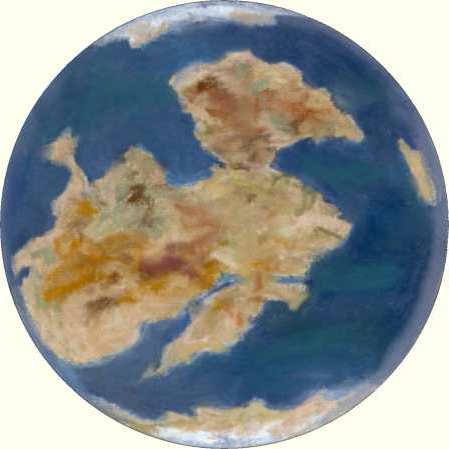
Greenwich Meridian 0° : 420 Million Years ago
In this map the main land mass is present day North America, Scandinavia, Northern Europe, Central Europe and most of Russia. (These lands were called Laurentia (North America, Canada) and Baltica (Scandinavia, Northern Europe, Central Europe)).
The slither of land to the South are fragments of the Eastern seaboard of North America, England, Irish Republic, Spain, France and a block leading through central Europe through to Bulgaria. This plate has been called Avalonia. It was during the late Silurian that this land mass finally crashed into the block to the North throwing up a mountain range along the line of the 'join'. This plate broke away from the southern supercontinent 500Myears ago.
Just north of the center of the map are the two halves of modern Russia (Baltica and Siberia) separated by a gulf. The two halves started pivoting together about 400Myears ago and completed in the formation of the Ural Mountains 150Myears ago.